XYZ format

A point cloud data file in XYZ format must contain rows of data. For a rectangular coordinate system, each row must consist of X-, Y-, and Z-coordinates followed by the field value at that point. The values in each row can be separated by any combination of spaces, tabs, or commas; each space, tab, or comma is considered a single field delimiter. Comma-separated values (CSV), shown in the following example, is a commonly used format:

X1,Y1,Z1,value
X2,Y2,Z2,value
X3,Y3,Z3,value
etc.
If you use a cylindrical or spherical local coordinate system, the appropriate coordinates must be given in the data file; see Coordinate system for point cloud mapped fields.

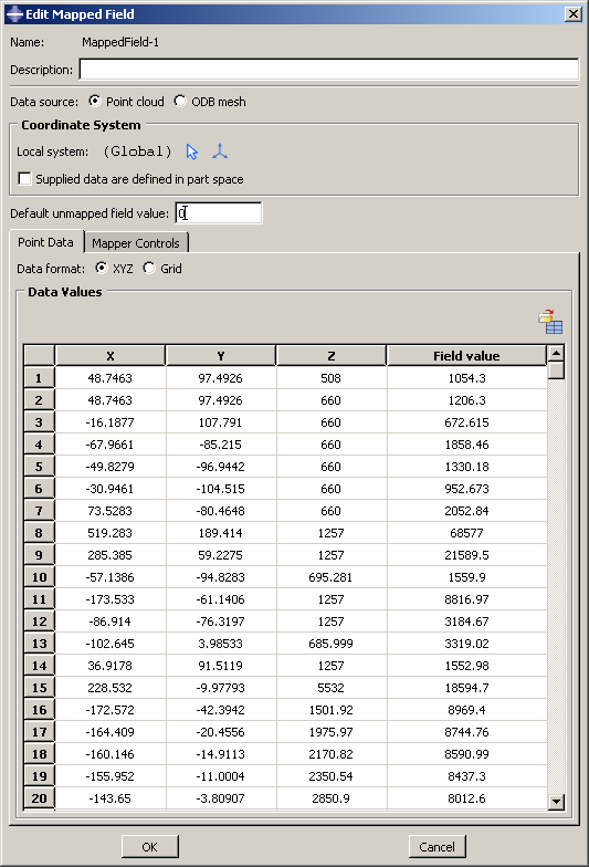
Figure 1 shows an example of point cloud data in XYZ format that have been imported into the Edit Mapped Field dialog box.

Figure 1. Point cloud data in XYZ format.